
Best Hikes Near Gatlinburg
When we're home in the midwest we like finding outdoor adventures. Even though it's a bit of a drive from Ohio, we will happily adventure to Tennessee for some of the best hikes near Gatlinburg.
We love being able to enjoy nature and do a lot of hiking. A cabin getaway in Gatlinburg is the perfect Schaub vacation giving us a mix of relaxation and exploring.
 There are easy hikes where you can take friends and family. For those more adventurous, there are tough hikes up mountains with beautiful vista points at the end.
We compiled a list of our favorite and best hikes near Gatlinburg. This way you can enjoy the area as much as we do.
These hikes are in the Smokey Mountains but easy to get to from Gatlinburg. All in one trip you visit a National Park and get a Gatlinburg vacation...you're welcome!
Disclosure: Links throughout the Mindful Nomadics site may make us a small commission at no additional cost to you. See our Affiliate Disclosure for more information.
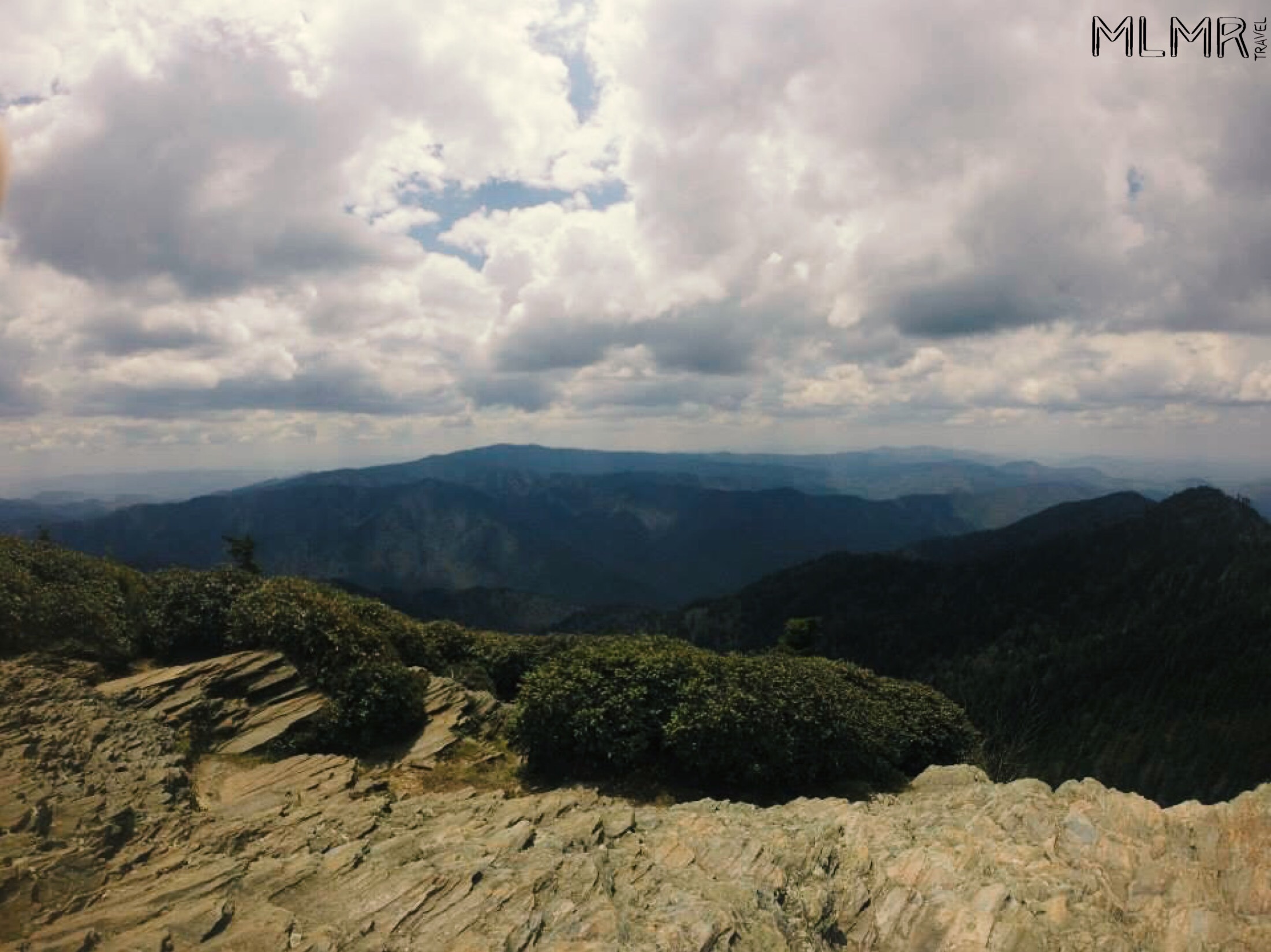
Mt LeConte
This is our absolute favorite hike in this area and we think the best hike near Gatlinburg. It can be a strenuous hike running anywhere from 11 miles to 14 miles round trip.
The length all depends on what route you go. We have gone up two of the routes, via Alum cave and Rainbow falls. Overall, we would highly suggest going up the alum cave trail.
The Trail
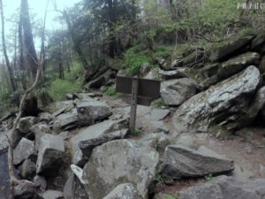 If you drive into the park you really can't miss the alum cave trailhead. It is on your left about nine miles after getting into the park. It can get pretty busy so you want to try to get there early. This way you can enjoy nature and more importantly, get a parking spot.
The trail has a couple of great natural stopping points at arch rock (1.3 miles one way) and Alum Cave (2.2 miles one way). Both of these spots are great for resting and taking in some great views.
They also serve as a good turnaround point if you got a late start or don't want to climb to the finish for whatever reason. After getting past Alum Cave you are in for some great panoramic views as you snake your way up the mountain.
Why It's the Best Hike
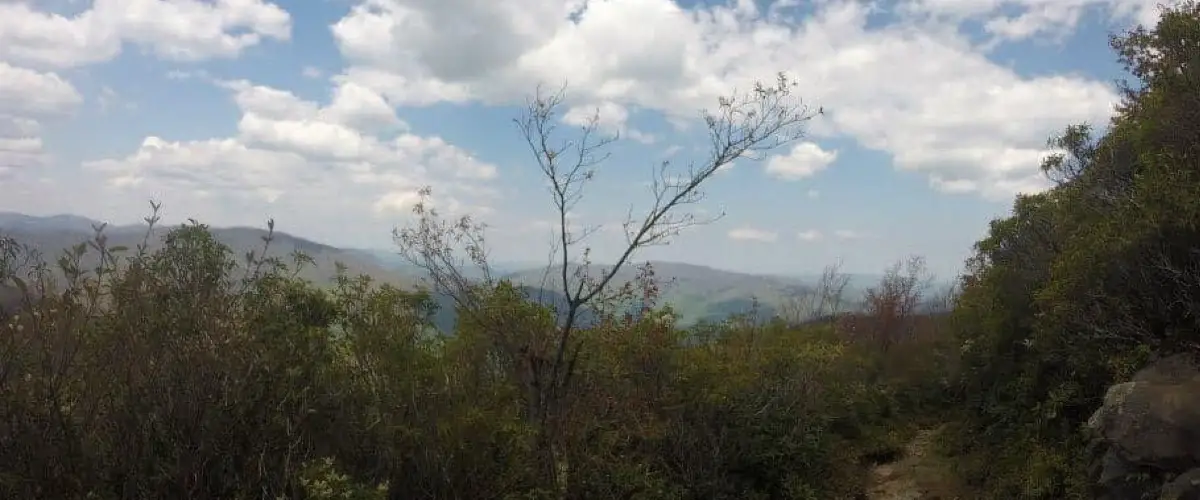
The view at the top is incredible and provides you with 180 degrees of freedom to look down on the Great Smoky Mountain National Park. We often will take a long lunch up there, just enjoying the silence with nature before heading back down.
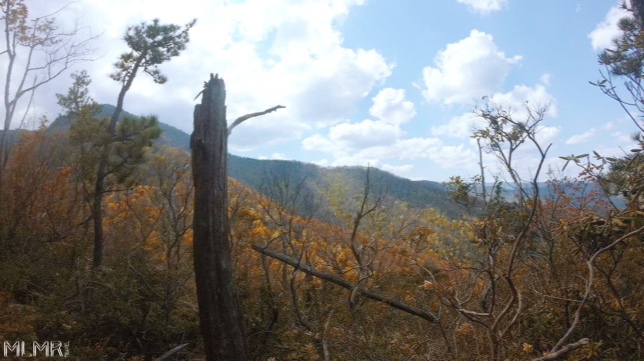
Chimney Tops
Chimney Tops was closed for over a year after a wildfire started there burned a large portion of the area around Gatlinburg in 2016/17. Before it was closed it was a beautiful, strenuous hike that was short but well worth the trip.
The Trail
The whole hike is only about four miles round trip but it packs a lot of elevation gain into those two miles. There is now a new observation point about a quarter-mile below the summit.
The area after it has been blocked off for now. Hopefully one day they will open up that area again because it was thrilling to be able to climb all over rocks and get a view of the park.
Why It's the Best Hike
The new observation deck provides great views and is decently safe. Even without the danger at the end, this is a must hike for anyone willing to put their legs through some (temporary) pain to get to the top.
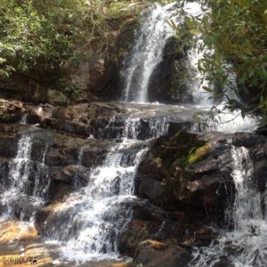
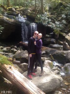
Rainbow Falls
Rainbow Falls is a part of the trail that leads up to Mt LeConte. If you don't want to hike up the mountain, Rainbow Falls is a great place to stop and enjoy the view.
The Trail
Rainbow Falls can be accessed via the historic nature trail/Airport Rd. This will lead you into the park and eventually to the trailhead. The roundtrip total to the falls and back is only 5.4 miles and it is not terribly steep with only about 1600 ft of elevation gain.
Why It's the Best Hike
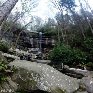 It is tucked away in a forest and you are hiking most of your time in a lush forest. Plus you have the river running next to you with footbridges to cross. Every time we have been there we have seen animals on or near the trail.
The giant waterfall at the end is the largest single drop waterfall in the park. It is not safe to get too close to the waterfall as the rocks are very slick but we always have lunch or a snack while watching the waterfall from a distance.
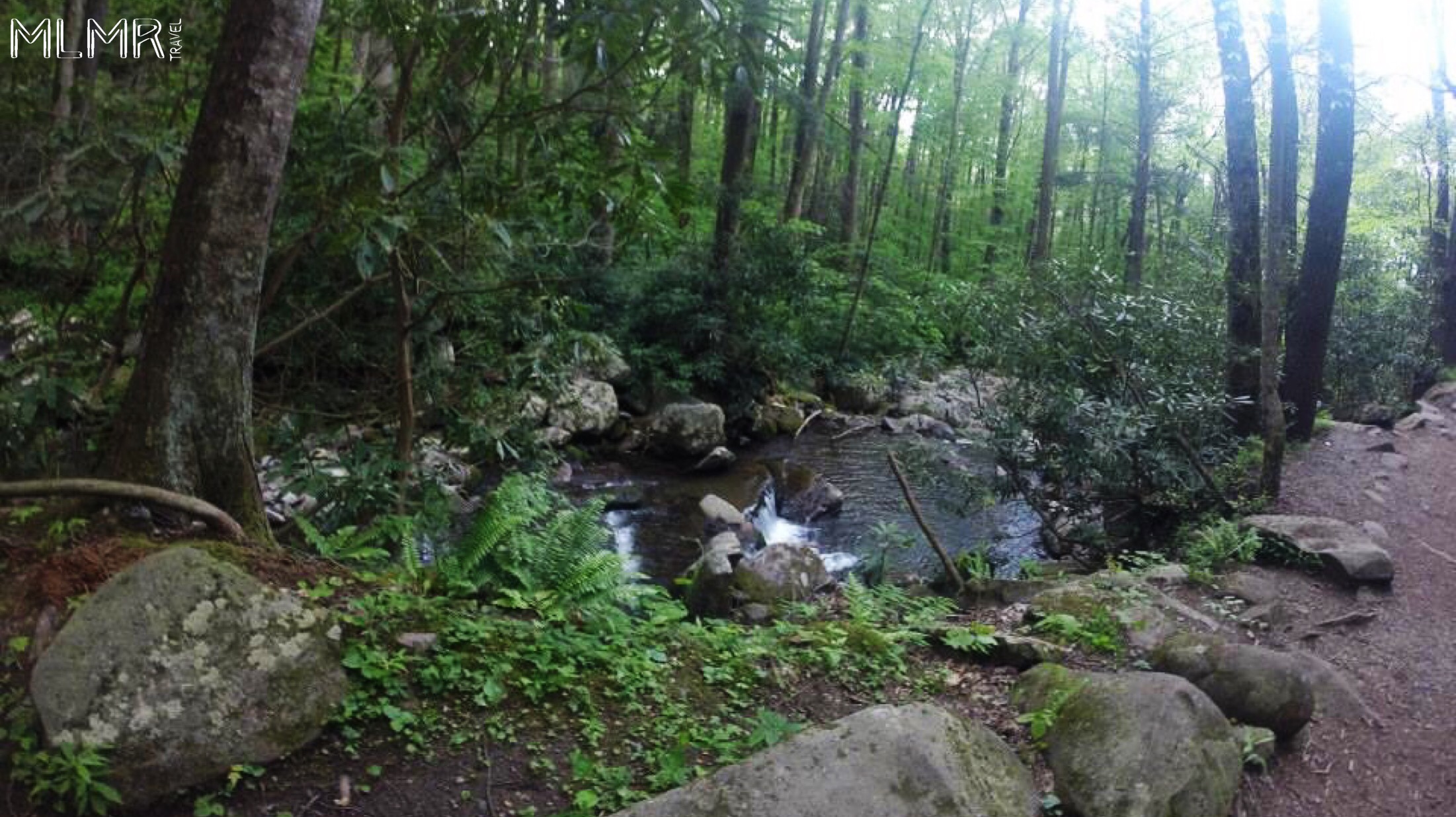
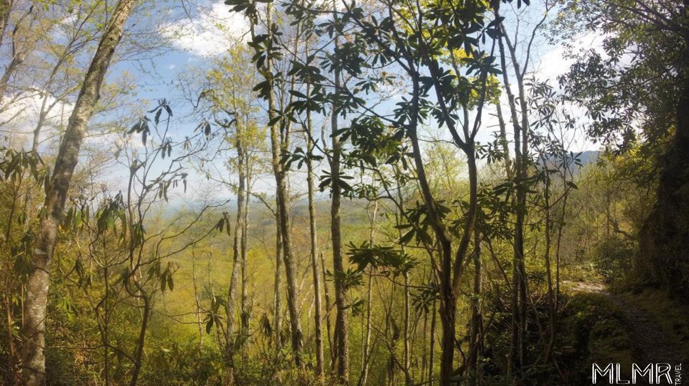
Little River Trail
If you are looking for something that doesn't have the big elevation gain but still is tranquil and has some great views, this is the trail for you.
The Trail
The trail runs right along a river for almost 2.5 miles one way, meandering back and forth over and back. We have always seen amazing wildlife there including slugs, snakes, deer, and more.
There are even otters in the water sometimes although we have never actually seen them. The trailhead for this hike is accessed via Elkmont Campground which is off of Little River Rd which splits off from the main road right after the Sugarlands Visitor Center.
Why It's the Best Hike
If you hike it during the spring you will likely see tons of blooming flowers so there are ample picture opportunities. The other nice thing about this trail is that you can connect it to a couple of other trails if you want to extend your hike. You can go up to Huskey Gap or make a loop back to your car using the cucumber gap trail.
Laurel Falls
 This is an extremely popular trail. This means parking can be tough and there are many hikers on the trail.
Since we like a little bit of solitude we typically start this hike first thing in the morning. We also have hiked it in the winter as well and that can be very enjoyable depending on how cold it is.
The Trail
The whole trail is only 2.3 miles roundtrip and can easily be accessed via the Little River Rd so it can be a good hike to do either before or after the Little River Trail.
There are two sections, an upper and a lower section that is divided by a walkway across the middle so you can get to both the top and the bottom with a little bit of exploring.
Why It's the Best Hike
There is a reason that it is so popular though and that is because the views of the waterfall are amazing. This hike is also very popular because the vast majority of it is paved. This means a lot of families with young kids and other people who don't generally get to the hard hikes will be on this hike with you.
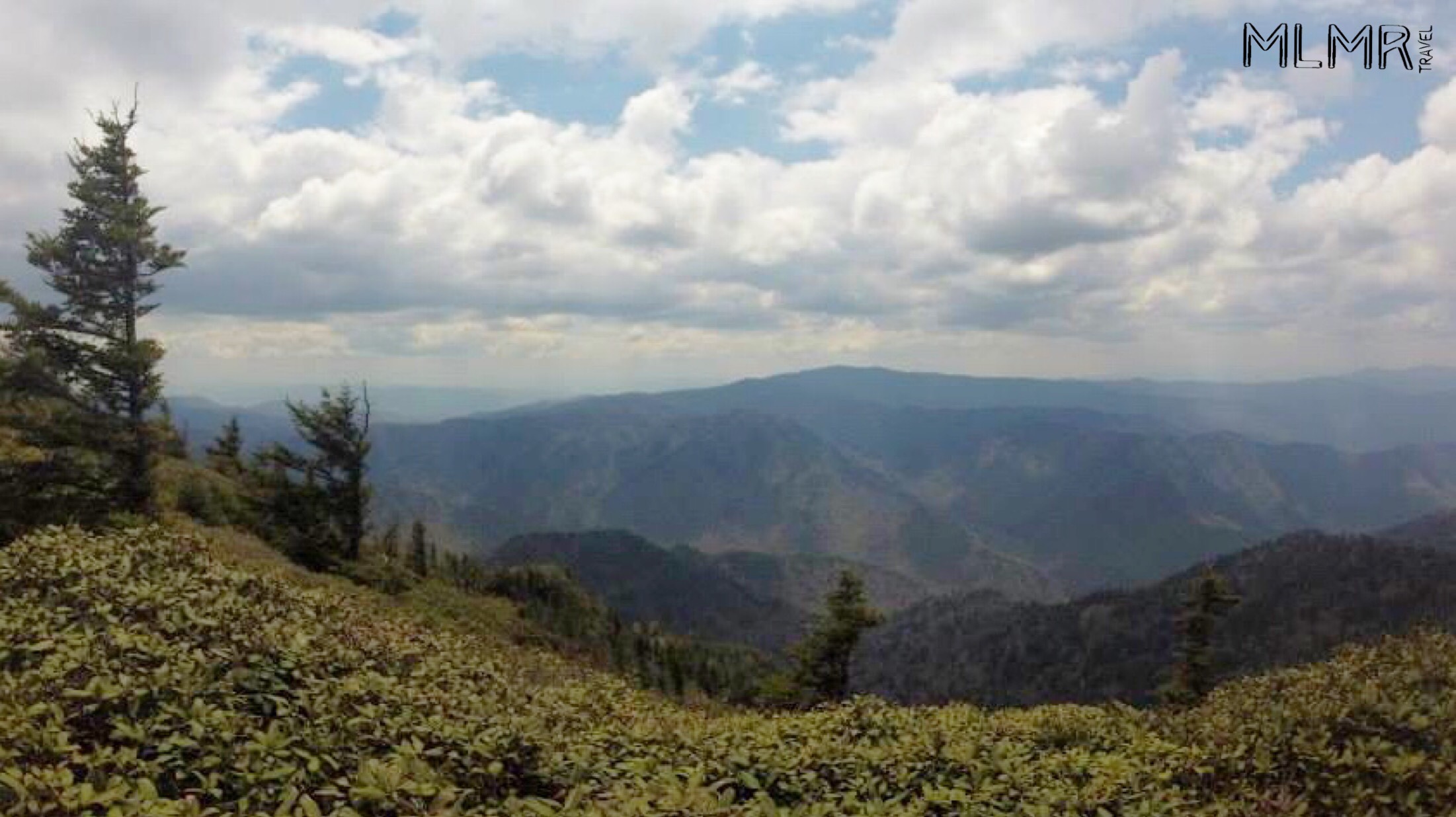
Clingmans Dome
Last but not least is Clingmans Dome. Do note that if you come here during the winter the road up to Clingmans dome is closed. This is a lookout point that towers above the whole park and lets you see for miles and miles but there is a little bit of a hike up to it.
The Trail
To get to Clingmans Dome just drive in the park, follow the signs for Newfound Gap (13 miles) and then turn to the right when you see signs for Clingmans Dome. Unfortunately, it is more of a drive than anything else.
You have to drive about 20 miles once you are inside the park just to get to the parking lot. It will be about seven miles to the parking area after you have turned onto Clingmans Dome Rd. This hike is nothing more than a five-minute uphill walk on a paved trail that leads to an observation deck.
Why It's the Best Hike
The time spent in the car might not seem worth it but trust us, that view from up there is well worth the trip. Since you get to see the entire park it's one of the best ways to enjoy just how beautiful this area is.
The Gatlinburg area will always be one of our go-to adventure spots while in the Midwest. Each hike is unique and brings something different to the nature experience. Happy hiking and let us know which one is your favorite!

